Inertial devices significantly enhance surveying and mapping. INS provide continuous position, velocity, and orientation data, crucial for navigation and dead reckoning in GPS-denied environments such as tunnels. IMUs (Built-in Gyroscopes and accelerometers) also stabilize and control survey equipment and provide motion compensation in dynamic settings. North finders, determining true north through Earth's rotation, ensure precise alignment and orientation, enhancing surveying accuracy and georeferencing. Together, these tools make surveying more robust, accurate, and reliable, particularly in challenging environments.
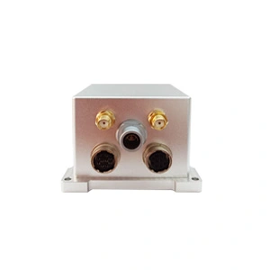
Mapping-level & Ultra-precision GNSS/MEMS INS
ER-GNSS/MINS-01:
1. High reliability and high precision;
2. Built-in full-band full-system dual-antenna positioning and orientation GNSS module;
3. Provide extremely accurate integrated navigation information.