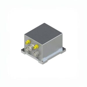
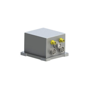
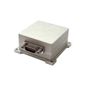
Ericco released a new GNSS-aided MEMS INS: ER-GNSS/MINS-01. The product can output continuous, ultra-precise position, velocity, and attitude information, providing new solutions for fields such as autonomous navigation, mapping, and motion analysis.
This is the highest-precision GNSS-aided MINS product among all Ericco's MINS products. It features a highly reliable, high-precision MEMS gyroscope (zero bias instability <0.02°/h) and accelerometer (range ±60g, zero bias instability <2μg), equipped with an integrated navigation fusion algorithm. Additionally, it integrates a high-performance GNSS module, ensuring continuous output of high-precision, high-reliability position, velocity, and attitude data during both long-term and short-term navigation.
The MEMS INS is mainly divided into two types: ER-GNSS/MINS-01A and ER-GNSS/MINS-01B.
Main Functions and Advantages of ER-GNSS/MINS-01:
1.Smaller Size
The GNSS-aided MINS measures 65mm*70mm*45.5mm and weighs less than 240g, making it particularly suitable for unmanned aerial vehicles with strict size and weight requirements.
2.Higher Precision
With very low noise gyroscopes, low latency, and high resistance to vibrations, the ER-GNSS/MINS-01 provides extremely precise integrated navigation information: attitude accuracy up to 0.01°, post-processing 0.004°, heading 0.05°, post-processing 0.01°.
The MEMS gyroscope has a zero bias instability of <0.02 °/h and angular velocity random walk of <0.005°/√h. The MEMS accelerometer has a zero bias stability(Allan) of <2μg and zero bias monthly repeatability of <±0.03mg.
3.Robust Positioning
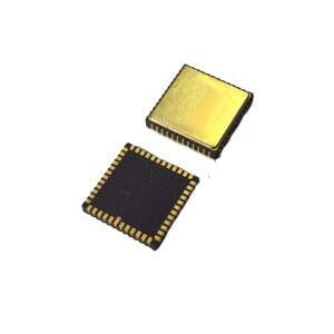
Integrated with dual antennas, all-system, all-frequency positioning and orientation GNSS module, and utilizing integrated navigation fusion algorithm. It provides continuous, accurate, and reliable positioning, attitude, and speed information even under complex GNSS conditions.
4.Easy to Install and Use
It offers a variety of data interfaces, making installation and usage easier. It supports RS422/RS232 and CAN.
Applications of ER-GNSS/MINS-01:
- Large unmanned aerial vehicles, flight data recorders, intelligent unmanned vehicles.
- Urban mapping, hydrological surveying, roadbed positioning and orientation.
Ericco boasts an excellent R&D team, and the ER-GNSS/MINS-01, as a flagship self-developed product, comes with a professional and efficient product line.
For more information on the ER-GNSS/MINS-01, please visit: Ericco International.
More Technical Questions
1. What Is GNSS-aided MEMS INS and How Does It Work?
2. How to Improve the Performance of MEMS Inertial Navigation Systems?
3. Full-temperature Performance Optimization Method For MEMS accelerometer
4. Classification And Performance Improvement Of MEMS Gyroscope
5. MEMS Accelerometer Packaging Technology
6. Performance Analysis of GNSS RTK Timing


