
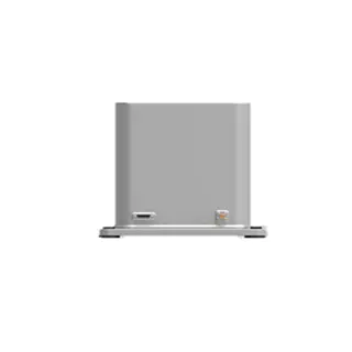
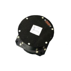
ER-FINS-40 High Precision Fiber Optic Inertial Navigation System
Introduction
ER-FINS-40 is an integrated navigation system with high precision and high reliability fiber optic gyroscope and quartz accelerometer, with integrated dual-antenna full-system full-frequency positioning satellite module. Equipped with integrated navigation fusion algorithm, it can provide continuous, accurate and reliable positioning, attitude and speed information under complex GNSS conditions. Can meet aviation, land and other applications.
Feature
Highly reliable and extremely accurate fiber optic gyroscopes (zero bias stability (1σ 100s) ≤035) and large range and high precision quartz accelerometers (±50g, stability <30ug).
Built-in full-band full-system dual-antenna positioning and orientation GNSS module, which supports single-antenna high-precision positioning and velocity measurement, and supports dual-antenna fast orientation function.
The system can provide extremely accurate integrated navigation information, attitude up to 0.01°, post-processing 0.004°, heading 0.05°, post-processing 0.01°
Built-in shock absorber, can better adapt to large vibrations and shocks.
Precision aluminum alloy shell, high reliability, can be widely used in land, aviation, navigation.
Application areas
Large UAV, flight data recorder, intelligent unmanned vehicle,
Urban mapping, hydrological survey,
Roadbed positioning and orientation,
Specifications
1.System parameter
| ER-FINS-40 | ||
| Roll & Pitch Accuracy | 0.01° | |
| 0.004° (Post Processing) | ||
| Heading | 0.05° Dual Antenna GNSS (baseline 2m) | |
| 0.01° (Post Processing) | ||
| RTK 30 sec outage | Roll&Pitch | Heading |
| 0.01° | 0.01° | |
| Position(X/Y) | Altitude(Z) | |
| 0.2m | 0.08m | |
| RTK 60 sec outage | Roll&Pitch | Heading |
| 0.01° | 0.01° | |
| Position(X/Y) | Altitude(Z) | |
| 0.5m | 0.1m | |
| Speed accuracy | 0.03m/s | |
| Alignment Time | 3min (Dual Antenna GNSS) | |
| 5min (No GNSS and in static environments) | ||
2.Sensor parameter
Gyroscope:
| No. | Item | Unit | |
| 1 | Measuring range | º/s | -500~+500 |
| 2 | Bias stability(1σ 10s) | º/h | ≤0.1 |
| 3 | Bias stability(1σ 100s) | º/h | ≤0.035 |
| 4 | Bias repeatability | º/h | ≤0.1 |
| 5 | Random walk coefficient | º/√h | ≤ 0.01 |
| 6 | Scale factor non-linearity | ppm | ≤50 |
| 7 | Scale factor repeatability | ppm | ≤ 50 |
| 8 | Scale factor asymmetry | ppm | ≤ 50 |
| 9 | Bandwidth | Hz | ≥500 |
Accelerometer:
| No. | Parameters | Unit | / |
| 1 | Range | g | ±50 |
| 2 | Threshold/Resolution | μg | 5 |
| 3 | Bias | mg | ≤ (±5) |
| 4 | 0g 4 Hours short time stability | μg | ≤30 |
| 5 | 1g 4Hours short time stability | μg | ≤30 |
| 6 | Bias repeatability | μg | ≤40 |
| 7 | Scale factor | mA/g | 1.3±0.2 |
| 8 | Class II non-linearity | μg /g2 | ≤ (±30) |
| 9 | Scale factor repeatability | ppm | ≤50 |
| 10 | Class II non-linearity repeatability | μg /g2 | ≤ (±30) |
| 11 | Noise(840ΩSampling resistor) | mv | ≤8.4 |
| 12 | Bandwidth | Hz | 800~2500Hz |
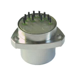
3.Power supply and interface:
| No. | Parameters | Unit | / |
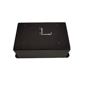
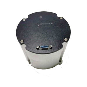
| 1 | Dimensions | mm | 100×100×75 |
| 2 | Operating temperature | ℃ | -40~+80 |
| 3 | Frequency of data output | Hz | 200 |
| 4 | Weight | Kg | 1.5 |
| 5 | Power supply | V | 28 |
| 6 | Communication interface | / | RS-422(Customizable) |
| GNSS | ||||
| Supported Navigation System | BDS/GPS/GLONASS/Galileo/QZSS | |||
| Main ANT Frequency | BDS:B1L, B2L, B3L
GPS:L1C/A, L2P(Y)/L2C, L5 GLONASS: L1, L2 Galileo: E1, E5a, E5b QZSS: L1, L2, L5 |
|||
| Slave ANT Frequency | BDS:B1L, B2L, B3L
GPS:L1C/A, L2C GLONASS: L1, L2 Galileo: E1, E5b QZSS: L1, L2 |
|||
| Position Accuracy (RMS) | Single point positioning | Horizontal | 1.5m | |
| Altitude | 2.5m | |||
| DGPS | Horizontal | 0.4m+1ppm | ||
| Altitude | 0.8m+1ppm | |||
| RTK | Horizontal | 0.8cm+1ppm | ||
| Altitude | 1.5cm+1ppm | |||
| Accuracy of observation (RMS) | ||||
| BDS | GPS | GLONASS | Galileo | |
| B1I/L1 C/A/G1/E1 pseudo-range | 10cm | 10cm | 10cm | 10cm |
| B1I/L1 C/A/G1/E1 Carrier Phase | 1mm | 1mm | 1mm | 1mm |
| B3I/L2P(Y)/L2C/G2 pseudo-range | 10cm | 10cm | 10cm | 10cm |
| B3I/L2P(Y)/L2C/G2 Carrier Phase | 1mm | 1mm | 1mm | 1mm |
| B2I/L5/E5a/E5b pseudo-range | 10cm | 10cm | 10cm | 10cm |
| B2I/L5/E5a/E5b Carrier Phase | 1mm | 1mm | 1mm | 1mm |
| Time accuracy (RMS) | 20ns | |||
| Speed accuracy (RMS) | 0.03m/s | |||
| First positioning time | <30s | |||
| Initialization time | <5s | |||
| Data update rate | <20Hz | |||
Application Techniques
1.Inertial Navigation System (INS)
2.What is Inertial Navigation System?
3.MEMS and FOG: How Should you Choose Inertial Navigation System?
4.In Autonomous Flight: How Inertial Navigation Systems Work
5.Development and Application of Inertial Navigation System
6.Introduction to Inertial Navigation Systems
More Products