
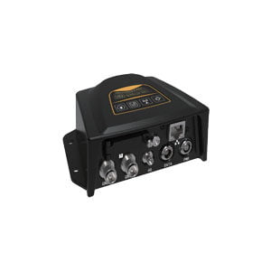
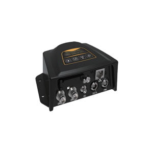
Geodetic GNSS Receiver
ER-GNSS-R06 is a cost-effective compact GNSS receiver designed for the construction of Beidou ground-based augmentation system, with built-in Linux operating system, completely independent intellectual property development, rich interface types, diverse communication methods, and support for large-capacity data storage. It is the best choice for the construction of the Beidou ground-based enhancement system by supporting the directional solution of the whole system and the independent differential output function of the double antenna.
Features
Linux+Qualcomm MDM9628 Cortex-A7 Intelligent System Platform
Features 1408 super-channels
Support BDS, GPS, GLONASS, Galileo, QZSS
Single antenna version supports PPS signal output
Supports front-end solving
Supports cloud services
Built-in 32G storage, 24GB available for remote download, supports multi-channel cyclic storage
Supports secondary development
Industrial grade design, strong aluminum alloy housing, in line with IP65 design requirements, safe and reliable
Specifications
| Performance Index | ||
| Hardware platform | Qualcomm MDM9628 Cortex-A7 | |
| Software Platform | Linux | |
| GNSS | GNSS Receive Frequency Points | BDS B1I/B2I/B3I/B1C/B2a |
| GPS L1/L2/L5 | ||
| GLONASS L1/L2 | ||
| Galileo E1/E5a/E5b | ||
| QZSS L1/L2/L5 | ||
| Channels | 1408 super channels | |
| Pseudo-distance observation accuracy (RMS) | 10.0cm | |
| Carrier phase observation accuracy (RMS) | 1.0mm | |
| Single-point positioning accuracy (RMS) | Level:1.5m Elevation:2.5m | |
| RTK Positioning Accuracy (RMS) | Level: 0.8cm+1ppm Elevation 1.5cm+1ppm | |
| Static Accuracy (RMS) | Horizontal:±(2.5mm+1ppm)Elevation:±(5mm+1ppm) | |
| Time Accuracy (RMS) | 20ns (excluding delays caused by RF cables or antennas ) | |
| Orientation accuracy (RMS) | 0.2°/1m | |
| System Platform | Positioning data | NMEA-0183 |
| Differential data | RTCM3.0, RTCM3.2, RTCM3.3 | |
| Storage format | RINEX, customized | |
| Data refresh frequency | 1Hz、2 Hz、5 Hz、10 Hz、20 Hz | |
| Received data availability | ≥98%(available data/captured data) | |
| Data integrity rate | ≥98%(collected data/data to be collected)
Standard RS232 interface Baud rate |
|
| Serial port | Support 9600,19200,38400,115200,230400bps | |
| Network port | Standard RJ45 interface,10/100Mbps network adaptive | |
| Network communication | all-netcom | |
| LTE FDD: B1/B3/B5/B8 | ||
| LTE TDD: B38/B39/B40/B41 | ||
| TD-SCDMA: B34/B39 | ||
| CDMA: BC0 | ||
| WCDMA: B1/B8 | ||
| GSM: 900/1800MHz | ||
| Built-in storage 32GB, available space 24GB, circular storage, supports multi-channel storage | ||
| Electrical Specifications | ||
| Voltage Input | 9-24V DC(Typical 12V) | |
| Power Consumption | 1.8W | |
| Physical indicators | ||
| Dimension | 135x102x47 mm | |
| Weight | ≤470g | |
| Protection class | Dust and waterproof IP65 | |
| Environmental indicators | ||
| Operating Temperature | -30~+70℃ | |
| Storage Temperature | -40~+85℃ | |
Application Techniques
1.Some Questions about GNSS Antenna
2.The Difference and Connection between GPS and GNSS
3.High-precision GNSS receiver design
4.Scientific Farming, With The Help of GNSS
5.The Working Principle of GNSS
More Products