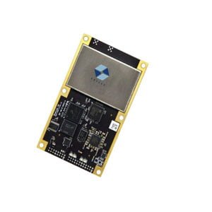
High Precision Integrated Navigation Positioning Module
ER-GNSS-M02 is a new cost-effective and high-precision integrated navigation and positioning module, which supports the multi-frequency signal reception of the whole constellation. The module adopts M02PIN LGA package, 17mm*22mm small size, high integration, low power consumption. ER-GNSS-M02 module is equipped with high precision RTK algorithm engine, which supports long baseline RTK solution and fast initialization. Built-in IMU, using tight combination algorithm, can continuously output stable and reliable navigation and positioning data in areas where satellite signals are seriously blocked. The ER-GNSS-M02's small size and low power design and excellent navigation and positioning performance can be widely used in high-precision GIS equipment, UAV, autonomous driving, agriculture and construction machinery and other fields.
Features
RTK GPS module, RTK GNSS module.
Support multi-frequency positioning of the whole constellations, support Beidou, GPS, GLONASS, Galileo, QZSS, NavIC six-star solution.
Equipped with a high-precision RTK algorithm engine, it is easy to achieve centimeter-level positioning.
Built-in IMU, using tight combination algorithm, can provide continuous navigation and positioning output.
Small size, low power consumption, easy system integration.
Supports long baseline RTK solutions and fast initialization.
Parameters
| GNSS performance indicators | |
| Satellite system | BDS, GPS, GLONASS, GALILEO, QZSS, NavIC |
| Tracking characteristics | GPS: L1, L5, GLONASS: G1, BeiDou: B1I, B2a
GALILEO: E1/E5a, QZSS: L1, L5, NavIC: L5 |
| Data Update rate | 10Hz |
| Horizontal accuracy | ≤8mm+1ppm |
| Carrier phase Observation accuracy | <0.01 cycle |
| Timing accuracy | 10ns |
| Capture sensitivity | -148dBm |
| Tracking sensitivity | -165dBm |
| Cold start | ≤24s |
| Warm start | ≤2s |
| Fixed solution convergence time | ≤5s |
| IMU Performance index | |
| Gyroscope | |
| Range | ±1000 deg/s |
| Zero bias stability | ±4.5 deg/h |
| Angular random Walk | 0.75deg/√h |
| Accelerometer | |
| Range | ±16g |
| Zero bias stability | ±0.25mg |
| Angular random Walk | 0.3m/s/√h |
| Roll accuracy | ≤0.02°(1σ) |
| Pitch accuracy | ≤0.02°(1σ) |
| Heading accuracy | ≤0.2°(1σ) |
| Inertial estimation accuracy | ≤1%*D(1σ,vehicle) |
| Data sampling rate | 50Hz |
| Communication indicators | |
| Data interface | 2 UART serial ports with 1PPS output |
| Baud rate | 115200 |
| Differential format | support RTCM3.x |
| Data format | NMEA0183 |
| Electrical characteristic | |
| Power consumption | 500mW |
| Environmental index | |
| Working Temperature | -40℃~+85℃ |
| Storage Temperature | -40℃~+90℃ |
| Humidity | 95% non-condensation |
| Mechanical indicators | |
| Dimension | 17mm*22mm |
| Packaging | LGA, 54 PIN |
Application Techniques
1.Some Questions about GNSS Antenna
2.The Difference and Connection between GPS and GNSS
3.High-precision GNSS receiver design
4.Scientific Farming, With The Help of GNSS
5.The Working Principle of GNSS
More Products


